Mainnavigation
Subnavigation
BORDER
Pagecontent
- You are here:
- Home »
- MLDesigner »
- Examples »
- Satellite Applications »
- Memory Requirements for Landsat 7 Satellite
A MLDesigner/SatLab Model to Analyze Memory Requirements for Landsat 7 Satellite
This is a joint MLDesigner-SatLab model depicting the picture generation, picture storage and transmission of pictures to ground stations for the Landsat 7 satellite. Pictures are generated over land during daytime and are stored until they can be transmitted to a ground station. Picture generation and storage are depicted dynamically during simulation.
Simulation parameters define the time required to create a picture, the time required to receive a picture, the time unit, and the minimum satellite elevation. Module parameters define the size of the on-board memory to store pictures until they can be transmitted to a ground station.
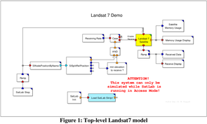
SatLab calculates the movement of Landsat and position relative to earth (pictures taken over land), position relative to daylight (operational in daylight hours) and position relative to ground stations (to determine when Landsat could download pictures.) The top-level model is shown below (Fig.1).
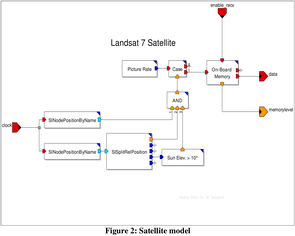
The figure 2 shows the contents of the satellite block in the top-model.
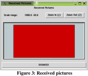
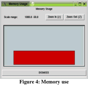
The two animation windows below (Fig.3 and 4) show the reception of pictures and the consumption of memory to buffer pictures during reception. These displays update dynamically during the simulation.
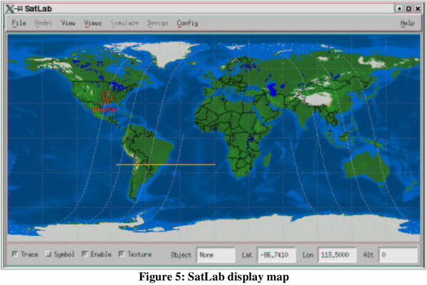
The SatLab dynamic map (Fig.5) shows the ground station and the path of the Landsat7 satellite.
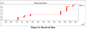
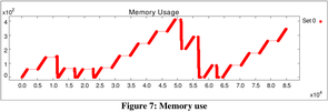
The two summary output displays below show received data and memory usage for the simulated operational period and the communications links used to transmit pictures.