Mainnavigation
Subnavigation
BORDER
Pagecontent
- You are here:
- Home »
- MLDesigner »
- Examples »
- Wireless/Mobile Applications »
- UMTS System Model
A MLDesigner and SatLab UMTS System Model
Analyze mission, performance and signal processing for fast moving mobiles in terrain
This mission-level analysis assesses the performance of the equalizer circuit of a wireless handset transceiver in a mission-level scenario using MLDesigner
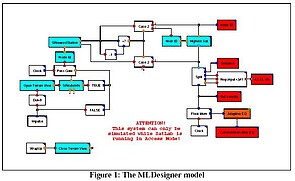
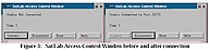
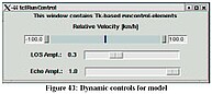
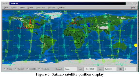
SatLab is connected to MLDesigner (Fig.3). When the simulation starts, a control window opens for dynamic parameter control (Fig.4). SatLab begins calculating the UMTS handset position for MLDesigner (Fig.5)

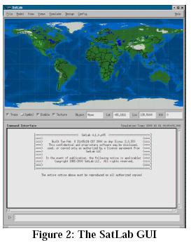
SatLab begins calculating satellite system positions relative to the UMTS handset.
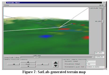
SatLab generates a dynamic 3D terrain map to show the position of the UMTS handset during simulation. (The handset is located in a vehicle moving down a road in rough terrain.) The map also shows the position of the base stations (small blue squares) and the available communications channels to the satellites and the ground stations. The model calculates channel handoffs based on signal availability and quality.
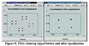
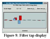
MLDesigner models the handset behavior and its geographic movement. MLDesigner dynamic displays show before and after signal constellation plots showing the effect of the equalizer algorithm in the UMTS handset transceiver (Fig.8) The dynamic display (Fig.9) shows the action of the handset filter taps.
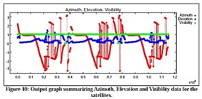
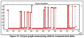
MLDesigner creates summary output graphs when the simulation completes.